Maps
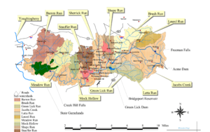
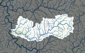
Jacobs Creek Watershed is approximately 98 square miles and contains over 177 miles of streams. It is located in both Fayette and Westmoreland counties and includes portions of the following municipalities:
Fayette County | Westmoreland County |
Bullskin Township | East Huntingdon Township |
Everson Borough | Mt. Pleasant Borough |
Lower Tyrone Township | Mt. Pleasant Township |
Upper Tyrone Township | Scottdale Borough |
Perry Township | South Huntingdon Township |
JCWA Recreation Map
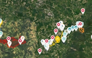
Click here to open the recreation map for the JCWA Watershed.
JCWA Watershed Implementation Plan
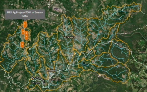
Click here to open the JCWA Watershed Implementation Plan ARCGIS map for imformation related to various runs and watersheds provided by the JCWA.
Jacobs Creek originates in the Laurel Highlands of southwestern Pennsylvania. At its headwaters, the creek is a cold water stream meandering across the top of the Chestnut Ridge. It plunges off the ridge and flows swiftly until it reaches the Bridgeport Dam where it becomes a warm water stream. Jacobs Creek then weaves its way through the lowlands of the scenic Fayette-Westmoreland region. Tumbling over waterfalls and through rapids, Jacobs Creek enters the Creek Hills area before reaching its confluence with the Youghiogheny River. Jacobs Creek has many tributaries, as shown on the map above.